

As we enter into the ninth month of the pandemic, scientists and researchers have continued to develop the testing and tracing of COVID-19 in public water resources and wastewater and learn how it impacts public health. The Centers for Disease Control and Prevention (CDC) and the U.S. Department of Health and Human Services have joined […]
tracking Covid-19
GIS Maps Help Governments, Health Organizations Track COVID-19
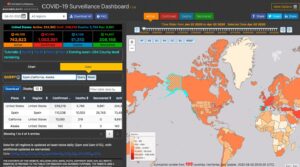
Various health, governmental, business, and other organizations have created Geographic Information Systems (GIS) maps to track the spread of COVID-19. Epidemiologists use GIS to look at variables, including demographics, environmental conditions, and historical data from past pandemics to determine the outbreak origins of COVID-19, the spread pattern of the disease, and the density of infection. […]